our platform
case studies
surveys
anywhere
Ellipsis Earth conducts surveys globally in remote regions, urban cities, coastlines, and rivers. We have been lucky to undertake surveys in India, Bangladesh, the Galapagos, Italy, France, UK, Spain, the Caribbean, Indonesia, Australia, Canada, and the USA.
We are calling on all councils, municipalities, districts, local and national governments around the world to leverage our technology to use data to define their litter strategy.

software with optional service
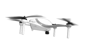
Our core product is the capability to map and track items of litter from images. As an additional service, Ellipsis Earth can gather the imagery with our in-house scientific survey team. This team is fully trained and insured to conduct air and ground surveys, anywhere in the world.
Alternatively, if you have your own staff, simply upload the images via the Ellipsis Earth App or Portal for rapid assessment.
baseline survey
To gain an understanding of how good or bad your cities litter situation is, a baseline survey will provide you with a one-time snapshot. This survey is conducted over 10 days in a statistically representative area of your city. In the Ellipsis Earth portal, you will be able to add geo-fences for site comparison, monitor bin performance, and track potential sources of litter. Using the heatmap, pinpoints, advanced data analysis and recommendations, your city will have all the data it needs for a data lead litter strategy.
campaign survey
If you wish to understand the impact of litter interventions and/or anti-littering campaigns, Ellipsis Earth can compare the litter increase and decrease from one survey to the next. Having access to such granular data demonstrates clear change within a site geofence, bin performance, intervention performance and source reduction.
ongoing survey
undertaken on a daily, weekly, monthly, quarterly, or annual basis, our clients understand their litter patterns over time to adapt their strategy to their seasons.